Saudi Arabia
Details
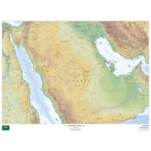
Saudi Arabia map
Saudi Arabia map shows all major cities including the capital city, Riyadh, and surrounding countries in clear and easy to read font. Major physical and political features of the country are highlighted on the map. The height above the sea level is also depicted using relief shading and different color hues.
You can view the national flag of Saudi Arabia on the bottom of the map. This flag has a green field with the Shahada or Muslim creed written in the Thuluth script. You can buy this detailed map in a selection of finishing materials that include paper, matte plastic, and laminate.
Where is Saudi Arabia?
Saudi Arabia is the largest sovereign state in the Middle East located in Western Asia, constituting the bulk of the Arabian Peninsula. It lies between latitudes 16° and 33° N, and longitudes 34° and 56° E.
The exact size of the country is not defined as its southern borders with the United Arab Emirates and Oman are not precisely marked.
Major Cities in Saudi Arabia
The five largest cities in the country by population are:
You can buy maps of all these cities and customize them around your central location. Click on the name of the city above to view the map.
Neighboring Countries
You can view all the bordering countries of Saudi Arabia on the map. We also have separate maps of these countries listed below:
More Information
| SKU | dmsg-rel-saudiarabia-1 |
|---|---|
| Map Scale | 1:2,200,000 |
| Flat Size | 48 x 36 in |
| Publication Date | 2018 |
| Publisher Name | MapSherpa |
Reviews
{{title}}
{{detail}}