West Indies - Atlas of the World, 10th Edition
Details
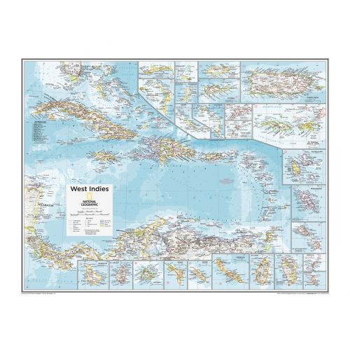
West Indies Map
This map is composed in classic National Geographic style and highlights fine details about the region. It was first published in March 1954 with two articles, "Jamaica - Hub of the Caribbean" and "Night Life in the Gulf Stream”.
The map also features thirty inset maps that provide spectacular details of the many islands in the Caribbean. You can purchase this high-quality map in a selection of finishes like paper, matte plastic, and lamination.
About West Indies
West Indies lies in the region of North Atlantic Ocean and the Caribbean and includes the island countries and surrounding waters of three major archipelagos: the Greater Antilles, the Lesser Antilles, and the Lucayan Archipelago. It also includes all the islands in or bordering the Caribbean Sea, The Bahamas, and the Turks and Caicos Islands.
Altogether, this geologically complex island consists of 7,000 islands and islets stretching over 3,000 km. These islands include low-lying atolls, active volcanoes, raised limestone islands, and large fragments of continental crust.
More Information
| SKU | ngmaps-POD10th049-1 |
|---|---|
| Flat Size | 28 x 22 in |
| Publication Date | 25-02-2015 |
| Publisher Name | National Geographic |
Reviews
{{title}}
{{detail}}