Poland and Czechoslovakia - Published 1958
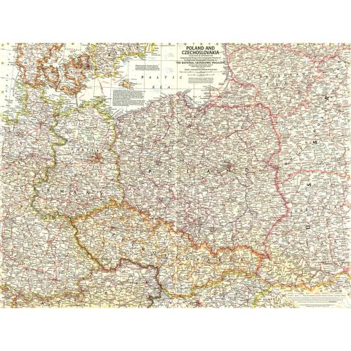
This detailed map of Poland and Czechoslovakia contains notes about territories and administration during the Cold War era. Several boundaries are shown including those before Germany's invasion of Austria and those between communist and non-communist countries. Published in September 1958.
Details
This detailed map of Poland and Czechoslovakia contains notes about territories and administration during the Cold War era. Several boundaries are shown including those before Germany's invasion of Austria and those between communist and non-communist countries. Published in September 1958.
More Information
| SKU | ngmaps-HM19580900-1 |
|---|---|
| Flat Size | 25 x 19 in |
| Publication Date | 1958 |
| Publisher Name | National Geographic |
Reviews
{{title}}
{{detail}}
No reviews yet ...
Have an opinion? Help others decide. Share your knowledge about this product by submitting a review.
{{/items}}
{{#previousPage}}
Previous Page
{{/previousPage}}
{{#load-more-src}}
Next Page
{{/load-more-src}}
★★★★★
★★★★★