Drainage Basins (1906)
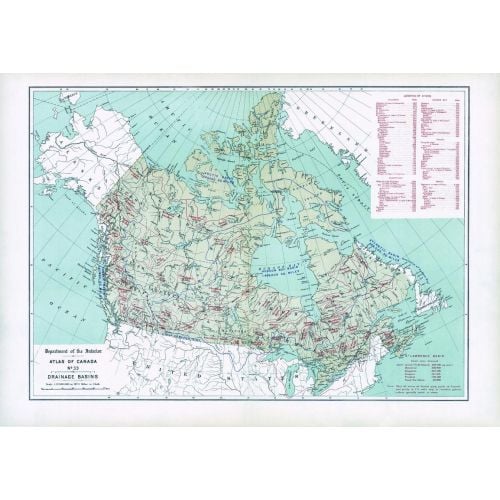
Contained within the 1st Edition (1906) of the Atlas of Canada is a map that shows the delineation of drainage basins. The geographic extent of each drainage basin is delineated and the total area drained for each basin is provided in square miles. This includes the great oceanic drainage basin and the Hudson Bay basin. Only the Canadian drainage area is indicated on the map for basins that lie partly in the United States. There is also a table listing the lengths of major rivers of Canada and their principal tributaries.
Details
Contained within the 1st Edition (1906) of the Atlas of Canada is a map that shows the delineation of drainage basins. The geographic extent of each drainage basin is delineated and the total area drained for each basin is provided in square miles. This includes the great oceanic drainage basin and the Hudson Bay basin. Only the Canadian drainage area is indicated on the map for basins that lie partly in the United States. There is also a table listing the lengths of major rivers of Canada and their principal tributaries.
More Information
| SKU | nrcan-294059-1 |
|---|---|
| Map Scale | 1:12,500,000 |
| Flat Size | 24.25 x 17.25 in |
| Publication Date | 1906 |
| Publisher Name | Natural Resources Canada |
Reviews
{{title}}
{{detail}}