2010 Olympic sites / Sites olympiques 2010
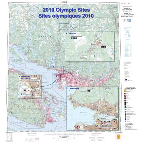
Contained within the Atlas of Canada Poster Map Series, is a large-format Olympics Sites wall map (42 inches by 45 inches) featuring a 1:250 000 scale topographic base map extending from the southern tip of Vancouver Island north to Pemberton and east to Abbotsford, British Columbia. It contains inset maps, at 1:50 000 scale of Vancouver and Whistler, from the new CanTopo map series to show these areas in greater detail. Additional thematic information has been added to these insets to highlight the location of the Olympics and Paralympics sites (for example ski runs, athletes' village, hockey arena).
Details
A large-format Olympics Sites wall map show these areas in greater details and additional thematic information highlight Olympics and Paralympics sites clearly.
More Information
| SKU | nrcan-294941-1 |
|---|---|
| Map Scale | 1:250,000 |
| Flat Size | 41.5 x 44.5 in |
| Publication Date | 2009 |
| Publisher Name | Natural Resources Canada |
Reviews
{{title}}
{{detail}}
No reviews yet ...
Have an opinion? Help others decide. Share your knowledge about this product by submitting a review.
{{/items}}
{{#previousPage}}
Previous Page
{{/previousPage}}
{{#load-more-src}}
Next Page
{{/load-more-src}}
★★★★★
★★★★★