Glacier and Waterton Lakes National Parks Map
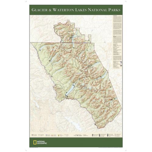
The wall map of Glacier and Waterton Lakes National Parks, based on the popular Trails Illustrated map of the area, provides rich topographic detail to show the Montana and Alberta parks' magnificent scenery, as well as updated trail and road information for the "Crown of the Continent."
Details
The wall map of Glacier and Waterton Lakes National Parks, based on the popular Trails Illustrated map of the area, provides rich topographic detail to show the Montana and Alberta parks' magnificent scenery, as well as updated trail and road information for the "Crown of the Continent."
More Information
| SKU | ngmaps-RE01020339-1 |
|---|---|
| Map Scale | 1:160,000 |
| Flat Size | 24 x 36 inches |
| Publication Date | 2007 |
| Publisher Name | National Geographic |
Reviews
{{title}}
{{detail}}
No reviews yet ...
Have an opinion? Help others decide. Share your knowledge about this product by submitting a review.
{{/items}}
{{#previousPage}}
Previous Page
{{/previousPage}}
{{#load-more-src}}
Next Page
{{/load-more-src}}
★★★★★
★★★★★