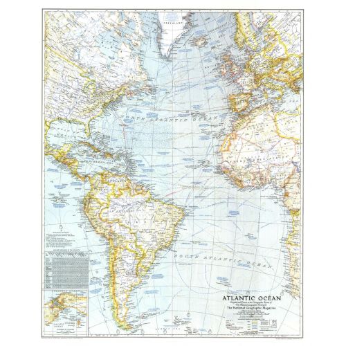
Atlantic Ocean - Published 1941
Published in September 1941, this map paints a striking portrait of the Atlantic Ocean on the verge of the US involvement in World War II. Naval bases, dates and locations of war-time events, time zone boundaries, shipping routes and air travel distances, as well as wind, current, and storm information, make this map a unique window into the turbulent times and the desire for a greater understanding of the Atlantic and its significance for travel, trade, and national security.
Details
Published in September 1941, this map paints a striking portrait of the Atlantic Ocean on the verge of the US involvement in World War II. Naval bases, dates and locations of war-time events, time zone boundaries, shipping routes and air travel distances, as well as wind, current, and storm information, make this map a unique window into the turbulent times and the desire for a greater understanding of the Atlantic and its significance for travel, trade, and national security.
More Information
| SKU | ngmaps-HM19410900-1 |
|---|---|
| Flat Size | 25.25 x 31.25 in |
| Publication Date | 1941 |
| Publisher Name | National Geographic |
Reviews
{{title}}
{{detail}}