Pacific Ocean - Published 1936
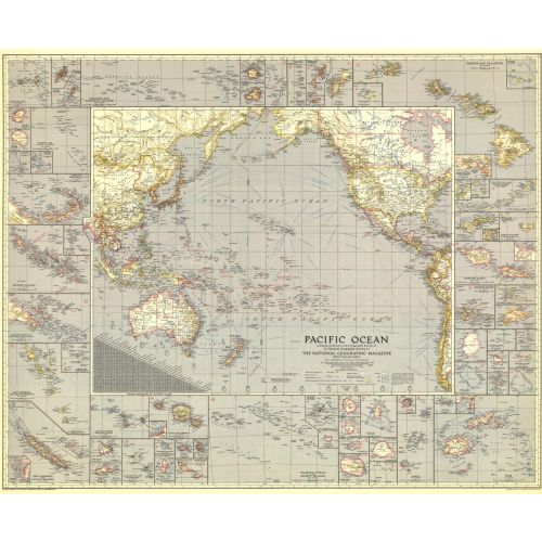
Explore the islands and coastlines of the Pacific with this thorough map of the region. With inset maps of dozens of islands and instructive details such as ship routes, naval bases, time zone boundaries and more, this map makes a wonderful collector's piece. Published in December 1936, it accompanied an article entitled "Flying the Pacific."
Details
Explore the islands and coastlines of the Pacific with this thorough map of the region. With inset maps of dozens of islands and instructive details such as ship routes, naval bases, time zone boundaries and more, this map makes a wonderful collector's piece. Published in December 1936, it accompanied an article entitled "Flying the Pacific."
More Information
| SKU | ngmaps-HM19361200-1 |
|---|---|
| Flat Size | 37.75 x 31 in |
| Publication Date | 1936 |
| Publisher Name | National Geographic |
Reviews
{{title}}
{{detail}}
No reviews yet ...
Have an opinion? Help others decide. Share your knowledge about this product by submitting a review.
{{/items}}
{{#previousPage}}
Previous Page
{{/previousPage}}
{{#load-more-src}}
Next Page
{{/load-more-src}}
★★★★★
★★★★★