Alaska Map - Published 1904
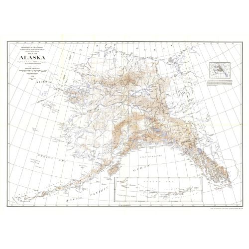
This historic map of Alaska shows the region after the boundary was agreed to with Canada. Published in National Geographic Magazine in 1904 with the article "The Geography of Alaska," this map includes an inset showing areas mapped by the U.S. Geological Survey. A wonderful companion to the Alaska Boundary Tribunal map printed the same year.
Details
This historic map of Alaska shows the region after the boundary was agreed to with Canada. Published in National Geographic Magazine in 1904 with the article "The Geography of Alaska," this map includes an inset showing areas mapped by the U.S. Geological Survey. A wonderful companion to the Alaska Boundary Tribunal map printed the same year.
More Information
| SKU | ngmaps-HM19040500-1 |
|---|---|
| Flat Size | 49.5 x 36 in |
| Publication Date | 1904 |
| Publisher Name | National Geographic |
Reviews
{{title}}
{{detail}}
No reviews yet ...
Have an opinion? Help others decide. Share your knowledge about this product by submitting a review.
{{/items}}
{{#previousPage}}
Previous Page
{{/previousPage}}
{{#load-more-src}}
Next Page
{{/load-more-src}}
★★★★★
★★★★★