Federal Lands in the Fifty States - Published 1996
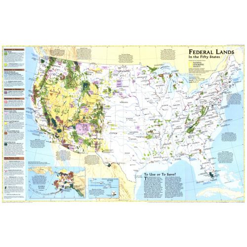
Considered by many to be the finest map of United States federal lands ever published. This map shows which land areas are controlled by each federal agency, and describes how each land type is managed. Published in October 1996 as a companion to "United States, the Physical Landscape."
Details
Considered by many to be the finest map of United States federal lands ever published. This map shows which land areas are controlled by each federal agency, and describes how each land type is managed. Published in October 1996 as a companion to "United States, the Physical Landscape."
More Information
| SKU | ngmaps-HM19961001-1 |
|---|---|
| Flat Size | 31.5 x 20.5 in |
| Publication Date | 1996 |
| Publisher Name | National Geographic |
Reviews
{{title}}
{{detail}}
No reviews yet ...
Have an opinion? Help others decide. Share your knowledge about this product by submitting a review.
{{/items}}
{{#previousPage}}
Previous Page
{{/previousPage}}
{{#load-more-src}}
Next Page
{{/load-more-src}}
★★★★★
★★★★★