Threading the Islands - Published 1986
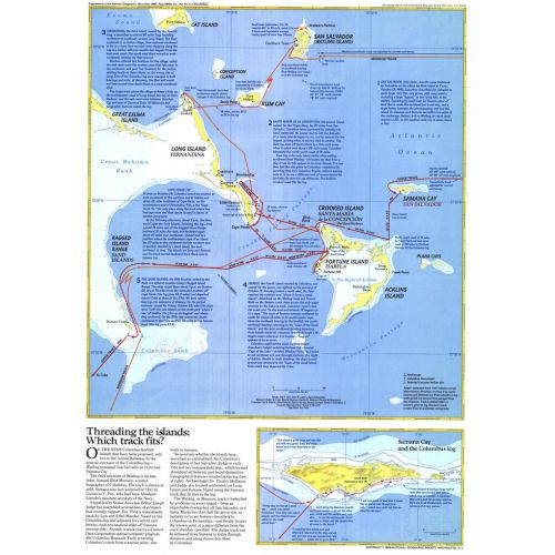
The "Threading the Islands" map explores two possible routes of Columbus's journey and possible landing sites. The Morisson track asserts that the explorer landed on San Salvador, while the Judge track favors Samana Cay. This map was printed in November 1986 to accompany three articles on Columbus and the "Where Did Columbus Discover America?" map. A fascinating new look at a centuries-old question.
Details
The "Threading the Islands" map explores two possible routes of Columbus's journey and possible landing sites. The Morisson track asserts that the explorer landed on San Salvador, while the Judge track favors Samana Cay. This map was printed in November 1986 to accompany three articles on Columbus and the "Where Did Columbus Discover America?" map. A fascinating new look at a centuries-old question.
More Information
| SKU | ngmaps-HM19861102-1 |
|---|---|
| Flat Size | 14.75 x 20.5 in |
| Publication Date | 1986 |
| Publisher Name | National Geographic |
Reviews
{{title}}
{{detail}}