Afghanistan, Pakistan
Details
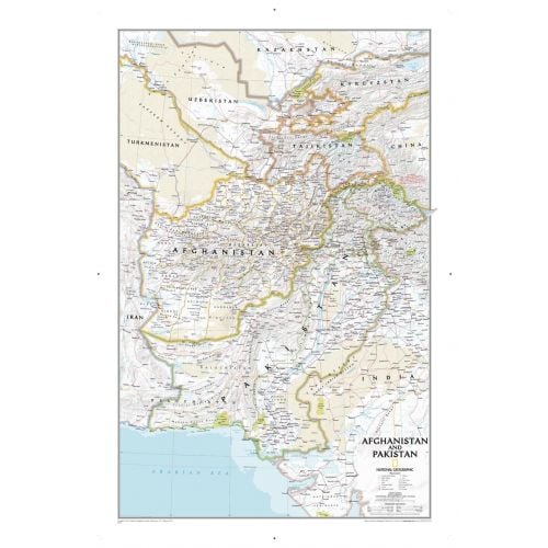
Pakistan Afghanistan Map
This National Geographics Pakistan Afghanistan map highlights the fine political details about the two countries and their surrounding areas. Relief shading used throughout the map depicts the terrains and land height.
The area covered by map ranges from Northern Africa through the Middle East to the western edge of China and India. You can view the major countries like Afghanistan, Pakistan, Tajikistan, Iran, Iraq, Kuwait, Syria, Israel, Jordan, Lebanon, Saudi Arabia, Qatar, Bahrain, United Arab Emirates, Yemen, Oman, Cyprus, and Eritrea. A small portion of India, China, Kyrgyzstan, Uzbekistan, Turkmenistan, Azerbaijan, Armenia, Turkey, Egypt, Sudan, Ethiopia, and Djibouti is also visible on the map.
You can buy maps of all these countries separately from the list below:
More Information
| SKU | ngmaps-RE01020436-1 |
|---|---|
| Map Scale | 1:3,363,000 |
| Flat Size | 21.5 x 32.75 inches |
| Publication Date | 2011 |
| Publisher Name | National Geographic |
Reviews
{{title}}
{{detail}}