Operational Navigation Charts
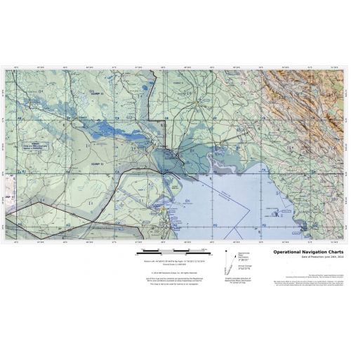
Published by the United States government in the 1980s and 1990s, Operational Navigation Charts are topographic maps with aeronautical information overlain. The maps show cities, main roads, important landscape features, railway lines, forests and waters. Relief is illustrated by highlights, contour lines (distances in feet ) and shading. Coverage includes the Mediterranean, Africa, the Middle East, across the Himalayas to Japan. Individual map sheets have been combined into a seamless layer. Suitable for print maps between 1:500,000 and 1:1,500,000.
Details
Published by the United States government in the 1980s and 1990s, Operational Navigation Charts are topographic maps with aeronautical information overlain. The maps show cities, main roads, important landscape features, railway lines, forests and waters. Relief is illustrated by highlights, contour lines (distances in feet ) and shading. Coverage includes the Mediterranean, Africa, the Middle East, across the Himalayas to Japan. Individual map sheets have been combined into a seamless layer. Suitable for print maps between 1:500,000 and 1:1,500,000.
More Information
| SKU | 54d52893fdd99f12ecd62e6dfb068858 |
|---|---|
| Map Specification | Min Print Scale - 1:2,000,000 Max Print Scale - 1:530,000 Optimal Print Scale - 1:1,000,000 |
| Publisher Name | MapSherpa |
Reviews
{{title}}
{{detail}}