Barrie Postal Code Map
Details
Barrie Postal Code Map
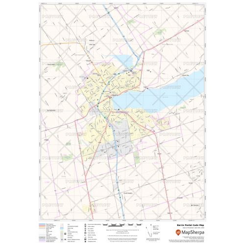
The postal code map of Barrie shows political boundaries, place names, highways, major parks and conservation areas, and points of interest. You can use this map for quick reference of infrastructures & other street details like interchanges, weigh stations and tolls. The map is ideal for tracking down delivery service areas, sales territories, and catchment areas. Moreover, it also assists in providing up-to-date information & is suitable to create multiple maps from city to county scales or anywhere in between.
You can create multiple maps by customizing this map around your business service area. Search for the location on the map and drag the arrows to define the print area. You can preview your map with all the details of the final print but at a much lower quality. The final map is available in high quality with clear boundaries that divide different postal codes. You also get the option to add a title and select your desired size, orientation, and finishing material.
About Barrie
Barrie is a manifesting regional center in Central Ontario. It is situated on the shores of Kempenfelt Bay, the western arm of Lake Simcoe. The city has seen significant growth in recent decades due to its emergence as a bedroom community, and its relatively close proximity to the city of Toronto. The city is highly centralized and has a historically strategic geographical orientation. It has also emerged as a popular tourist destination in Central Ontario and is often called "The Gateway to Cottage Country".
About Postal Codes
Each administrative division maintains its own postal code for mail delivery purposes. The correct code is essential for mails delivery. The postal address in Canada is categorized into two sections, Forward Sortation Area, the initial segment and the Local Delivery Unit. Configuration of the postal codes is determined if the state, city, or territory has the right combination of the province identity, a numeral representing the Forward Sortation Area, and another alphabet denoting the subdivision (districts, or smaller cities).
The Forward Sortation Area of Barrie ranges from L4M to L4N, L9J, and L9X.
You can also view the Canada Postal Code Map, Calgary Alberta Postal Code Map, Edmonton Alberta Map, Edmonton Map, and Map of Downtown Edmonton Alberta
More Information
| SKU | ecfe74dcf99c2bec1d4450323d39fec2-Barrie-P-ON |
|---|---|
| Map Specification | Max Print Scale - 1:15,000 Min Print Scale - 1:2,000,000 Optimal Print Scale - All |
| Publisher Name | MapSherpa |
Reviews
{{title}}
{{detail}}