Maritimes Wall Map - Large
Details
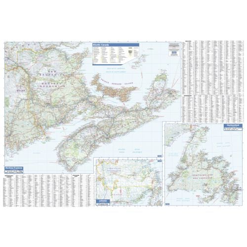
Canadian Maritime Map
This high-quality Canadian Maritime map is ideal for your home study or office wall decor. It displays the features of Canada's Atlantic provinces in muted earthy colors. You can view all highways, cities and towns, major parks, political boundaries, and points of interest on this detailed map.
Designed with a traditional Canadian style, the Canadian Maritime Map has been embraced by map buyers over many years. It includes a helpful place name index which makes it easier to locate places. The separate inset maps of Newfoundland and Labrador also gives detailed street information.
About Canadian Maritime Provinces
The Maritimes province consists of three provinces: New Brunswick, Nova Scotia, and Prince Edward Island (PEI). These 3 provinces with Newfoundland and Labrador make up the region of Atlantic Canada Province. It is located northeast of New England, southeast of Quebec's Gaspé Peninsula, and southwest of the island of Newfoundland.
You can also explore the maps of the 4 Canadian Maritime regions: Nova Scotia, New Brunswick, Prince Edward Island, and Newfoundland and Labrador.
More Information
| SKU | lucidmap-LWM43-1 |
|---|---|
| Map Scale | 1:750,000 |
| Flat Size | 54 x 37.5 in |
| Publication Date | 2016 |
| Publisher Name | Lucidmap |
Reviews
{{title}}
{{detail}}