Central Europe and the Mediterranean - Published 1939
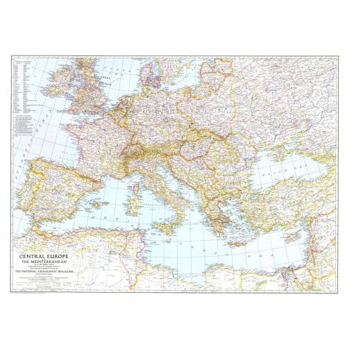
This map of Central Europe and the Mediterranean shows international boundaries as of September 1, 1939, before Germany invaded Poland. Published in October 1939, this map appeared with the article "War Clouds Over Danzig and Poland's Port." A unique historical map for collectors.
Details
This map of Central Europe and the Mediterranean shows international boundaries as of September 1, 1939, before Germany invaded Poland. Published in October 1939, this map appeared with the article "War Clouds Over Danzig and Poland's Port." A unique historical map for collectors.
More Information
| SKU | ngmaps-HM19391000-1 |
|---|---|
| Flat Size | 37.25 x 27.5 in |
| Publication Date | 1939 |
| Publisher Name | National Geographic |
Reviews
{{title}}
{{detail}}
No reviews yet ...
Have an opinion? Help others decide. Share your knowledge about this product by submitting a review.
{{/items}}
{{#previousPage}}
Previous Page
{{/previousPage}}
{{#load-more-src}}
Next Page
{{/load-more-src}}
★★★★★
★★★★★