Pakistan
Details
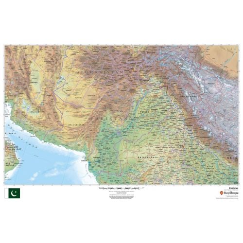
Pakistan map
Pakistan map shows all major cities including the capital city, Islamabad, and surrounding countries in clear and easy to read font. Major physical and political features of the country are highlighted on the map. The height above the sea level is also depicted using relief shading and different color hues.
You can view the national flag of Pakistan on the bottom of the map. This flag has white star and crescent on a dark green field and a vertical white stripe at the hoist. You can buy this detailed map in a selection of finishing materials that include paper, matte plastic, and laminate.
Where is Pakistan?
Pakistan in South Asia has a geopolitically important location at the crossroads of South Asia, the Middle East, and Central Asia. It has a coastline along the Arabian Sea and the Gulf of Oman in the south.
Major Cities in Pakistan
The five largest cities in the country by population are:
You can buy maps of all these cities and customize them around your central location. Click on the name of the city above to view the map.
Neighboring Countries
You can view all the bordering countries of Pakistan on the map. We also have separate maps of these countries listed below:
More Information
| SKU | dmsg-rel-pakistan-1 |
|---|---|
| Map Scale | 1:3,000,000 |
| Flat Size | 36 x 24 in |
| Publication Date | 2018 |
| Publisher Name | MapSherpa |
Reviews
{{title}}
{{detail}}