New Zealand - Atlas of the World, 10th Edition
Details
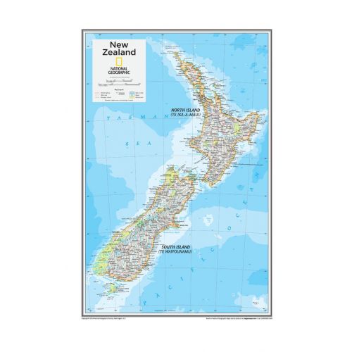
Detailed Map of New Zealand
This National Geographic's detailed map of New Zealand highlights the fine political details about the country and its surrounding areas. It uses relief shading throughout the map to depict the terrains and land height. Both North Island and South Island are shown on the map. You can view all major cities including the capital city, Wellington, on the map.
This high-quality map of New Zealand is available in a selection of finishes that include paper, matte plastic, and laminate.
About New Zealand
New Zealand in the southwestern Pacific Ocean comprises of two main landmasses- the North Island and the South Island- and around 600 smaller islands. It lies 2,000 kilometers (1,200 mi) east of Australia across the Tasman Sea.
The South Island divided along its length by the Southern Alps is the largest landmass of New Zealand and is the 12th largest island in the world. Whereas the North Island, that is a less mountainous area but is marked by volcanism is the 14th largest island in the world.
The 5 largest cities in New Zealand by population are also listed below:
You can buy maps of these cities by clicking on their names above. All these city maps are customizable and can be centered around your preferred location, your neighborhood, or your business service area.
More Information
| SKU | ngmaps-POD10th108a-1 |
|---|---|
| Flat Size | 14 x 22 in |
| Publication Date | 25-02-2015 |
| Publisher Name | National Geographic |
Reviews
{{title}}
{{detail}}