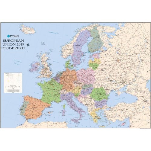
European Union 2019 Post Brexit Wall Map
The European Union 2019 Post-Brexit Political wall map is ideal for the office or educational environment. This unique EU map features political colouring showing Europe and the member countries of the European Union. All major Towns, Roads, Rivers and Lakes are shown on this map. This map shows the British Isles as they will appear once the UK has completed leaving the EU!
Details
The European Union 2019 Post-Brexit Political wall map is ideal for the office or educational environment. This unique EU map features political colouring showing Europe and the member countries of the European Union. All major Towns, Roads, Rivers and Lakes are shown on this map. This map shows the British Isles as they will appear once the UK has completed leaving the EU!
More Information
| SKU | xyz-9781910937983-1 |
|---|---|
| Map Scale | 1:4,600,000 |
| Flat Size | 47 x 33.25 in |
| Publication Date | 2017 |
| Publisher Name | XYZ Maps |
Reviews
{{title}}
{{detail}}