National Parks
Find National Parks maps of the US, UK, Canada, and many other countries. These maps highlight magnificent national parks and trails with separate inset maps providing detailed descriptions of relief, landscapes, river systems with updated trail and road information. Rich topographic details and splendid scenery makes these maps a must have while traveling and exploring.
-
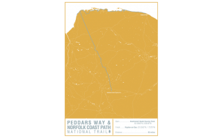 Peddars Way and Norfolk Coast Path National Trail Map Print
This map print highlights the National Trail route of the Peddars Way and Norfolk Coast Path, showing the start and finish points on an attractive relief base and created in the official National Trail colours.
Learn MorePrice from $27.99 -
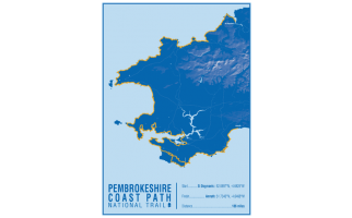 Pembrokeshire Coast Path National Trail Map Print
This map print highlights the National Trail route of the Pembrokeshire Coast Path, showing the start and finish points on an attractive relief base and created in the official National Trail colours.
Learn MorePrice from $27.99 -
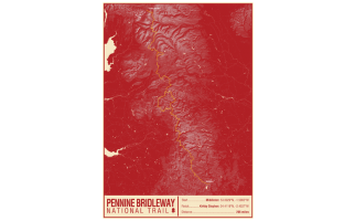 Pennine Bridleway National Trail Map Print
This map print highlights the National Trail route of the Pennine Bridleway, showing the start and finish points on an attractive relief base and created in the official National Trail colours.
Learn MorePrice from $27.99 -
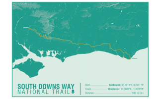 South Downs Way National Trail Map Print
This map print highlights the National Trail route of the South Downs Way, showing the start and finish points on an attractive relief base and created in the official National Trail colours.
Learn MorePrice from $27.99 -
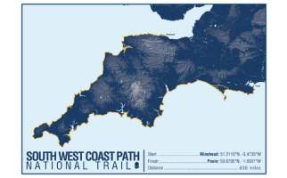 South West Coast Path National Trail Map Print
This map print highlights the National Trail route of the South West Coast Path, showing the start and finish points on an attractive relief base and created in the official National Trail colours.
Learn MorePrice from $27.99 -
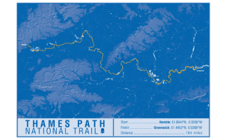 Thames Path National Trail Map Print
This map print highlights the National Trail route of the Thames Path, showing the start and finish points on an attractive relief base and created in the official National Trail colours.
Learn MorePrice from $27.99 -
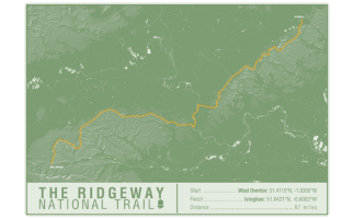 The Ridgeway National Trail Map Print
This map print highlights the National Trail route of the Ridgeway, showing the start and finish points on an attractive relief base and created in the official National Trail colours.
Learn MorePrice from $27.99 -
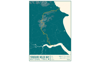 Yorkshire Wolds Way National Trail Map Print
This map print highlights the National Trail route of the Yorkshire Wolds Way, showing the start and finish points on an attractive relief base and created in the official National Trail colours.
Learn MorePrice from $27.99 -
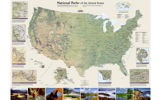 United States Map National Parks
This Map of the USA features hundred of parks all over the State.
The topography of the country is presented painted relief features.
The scenery of some of the parks protected by the National Park System is highlighted with captivating photo images .
A number of other insets arranged around the map give detail information on seven park sites which include Yellowstone, Acadia, Grand Canyon, Great Smoky Mountains, Everglades, and Zion
This elaborate US National parks Map is designed by National Geographic to draw attention to the variety of natural landscape that the country has to offer.
Learn MorePrice from $42.99 -
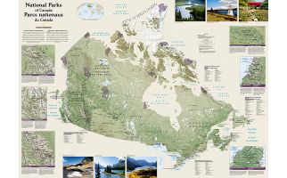 Canada National Parks Map
Wall map of Canada's National Parks highlighting the magnificent parks across the country. Colorful photos capture some of the diverse landscapes preserved and protected by the national park system. Separate inset maps provide detail and descriptions of several of the parks including Jasper, Yoho, Banff, Riding Mountain, Gros Morne and Cape Breton Highlands.
Learn MorePrice from $42.99