Top World Maps
Find every bestselling world map from eminent map publishers in one place! Ranging from legacy maps, Pacific centered maps, to the graphic world map, this collection has it all. These maps are a great source for both geographic and political information. Available in various styles like antique, classic, and contemporary they are perfect for home, business, and educational references.
-
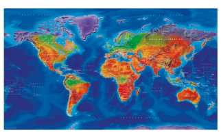
 Artistic World Wall Map - Large
World political mapping and vibrant colours combine to make this beautiful, colourful map with a difference.
Learn MorePrice from $48.99 -
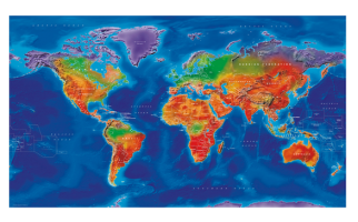
 Artistic World Wall Map
World political mapping and vibrant colours combine to make this beautiful, colourful map with a difference.
Learn MorePrice from $34.99 -
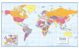
 Colour blind friendly Political Wall Map of the World - Large
There is likely to be at least one child in every classroom that is colour blind. Designed especially to work with any form of colour blindness, this colourful, easy to read children's map of the World showing the countries and their capitals is ideal for the classroom.
Learn MorePrice from $69.99 -
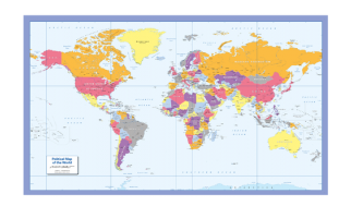
 Colour blind friendly Political Wall Map of the World
There is likely to be at least one child in every classroom that is colour blind. Designed especially to work with any form of colour blindness, this colourful, easy to read children's map of the World showing the countries and their capitals is ideal for the classroom.
Learn MorePrice from $39.99 -
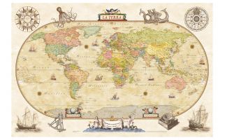 Political World Wall Map - Antique Style - Italian
Fashion political world map done in earth-toned colors. Toponomy is in Italian.
Learn MorePrice from $44.99 -
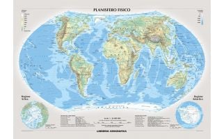 Physical World Wall Map - Italian
Attractive physical wall map of the world in Italian.
Learn MorePrice from $54.99 -
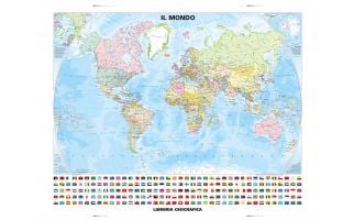 Political World Wall Map - Country Flags - Classic Style - Italian
Classic World Map in Italian that includes official national flags.
Learn MorePrice from $54.99 -
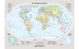 Political World Wall Map - Italian
Attractive political wall map of the world in Italian.
Learn MorePrice from $54.99 -
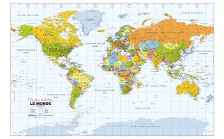 Political World Wall Map, French Language
Political World Wall Map in French. Carte des murs du monde politique en français.
Learn MorePrice from $44.99 -
 Political World Wall Map, Spanish Language
Political World Wall Map in Spanish. Mapa político del muro mundial en español.
Learn MorePrice from $34.99 -
 Political World Wall Map, Portuguese Language
Political World Wall Map in Portuguese. Mapa do Muro Mundial Político em Português.
Learn MorePrice from $34.99 -
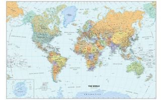 Classic World Wall MapPerfect for home, business, or school, this Classic World Wall Map combines warm, traditional colors with high-detailed cartography. Details on this World Wall Map include: international boundaries and national capitals along with other major cities; major physical features such as mountain ranges, major mountain peaks, island chains, and deserts; and major water features such as oceans, seas, gulfs, and rivers. Special features include light blue-colored oceans, a white border, and an inset of Antarctica. This map of the world uses the Van Der Grinten projection. The 2020 edition features several city-name changes in Alaska, Angola, South Africa, and Turkmenistan. Learn MorePrice from $44.99