World Map for Kids
The collection of maps for kids include resources that are perfect for your budding geographers or travelers. You can find entertaining maps like the kid's cartoon map, educational maps ideal for grade K-3 to 12, and World map for kids with countries. The maps include fun illustrations with easy to read fonts and labels. These maps for kids are published by renowned publishers and are available in various finishing materials like paper, matte plastic, and lamination.
-
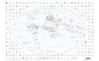 National Geographic's World Coloring Map with Flags MapEducational and fun - Color in your own National Geographic map at home while learning about the world! Suitable for school age children, teens, and adults - a great activity for the whole family. Learn MorePrice from $31.99
 -
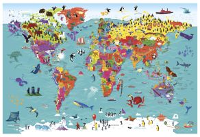
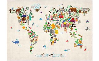 Kids Animal Map of the World
Colourful and vibrant map of the world made from animals. Look closely and you will see the animals are shown in their home continents. Can you spot the African Lion or the Chinese Panda? This Children's Animal Map of the World will look great on your child's bedroom or nursery wall and is a fun way to help younger children learn about the world.
Learn MorePrice from $32.99 -
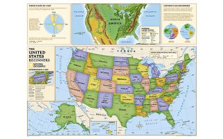 Kids Beginners USA Education: Grades K-3
Geography can be best understood with maps and this United States Map for kids is especially improvised to aid classroom teaching. This graded series map, designed by National Geographic Maps is a perfect tool to enhance cognitive skills and spatial thinking for children in middle and high school levels.
Learn MorePrice from $64.99 -
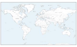
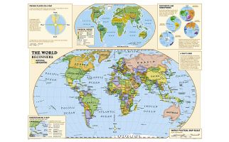 Kids Beginners World Education: Grades K-3
Beginners USA Education map of the world for grades K-3. National Geographic's graded-series of maps are the first to address the unique needs of K-12 students as they advance their understanding of our World.
Learn More
Unlike other classroom poster maps, the world maps use the Winkel-Triple projection, which provides the best combination of size, shape, and distance giving the student the best visual representation of the Earth's surface in two dimensions. This solves the effect seen on other maps where Greenland appears larger than South America.
Our Beginner Series, grades K-3, contains an easy to read maps of the World and United States.Price from $59.99 -
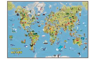 Kids Cartoon Map of the World
This is a fantastic fun Children's Illustrated Map of the World perfect for Children aged 5 upwards. The detailed illustrations show people and local culture, animals and marine life, famous natural features and manmade landmarks plus a range of other fun illustrations. Find the Polar Bears playing catch or the Aborigines dancing to the didgeridoo, plus learn where the Victoria Falls or Mount Everest are in the world. The World Map itself show the Continents, Sea and Ocean names and also shows hill and sea shading.
Learn MorePrice from $34.99 -
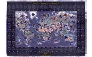 Mythical Monster Premium Wall Map - MediumThe Mythical Monster Map was created by Peter Dobbin, a renowned UK artist. The stunning monster images portrayed on a map of the world bring life to myths and legends that have emerged around the planet.
The map shows 61 creatures and includes their country of origin and a description of their characteristics. Learn More
Price from $29.99 -
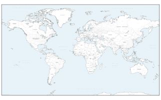
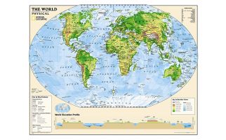 Kids Physical World Education: Grades 4-12
Physical map of the world for grades 4-12. National Geographic's graded-series of maps are the first to address the unique needs of K-12 students as they advance their understanding of our World.
Learn More
Unlike other classroom poster maps, the world maps use the Winkel-Triple projection, which provides the best combination of size, shape, and distance giving the student the best visual representation of the Earth's surface in two dimensions. This solves the effect seen on other maps where Greenland appears larger than South America.
Our Physical Series, grades 6-12, helps advancing students understand the World's diverse landforms, Oceans, and terrain.Price from $59.99 -
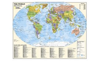 Kids Political World Education: Grades 4-12
Political map of the world for grades 4-12. National Geographic's graded-series of maps are the first to address the unique needs of K-12 students as they advance their understanding of our World.
Learn More
Unlike other classroom poster maps, the world maps use the Winkel-Triple projection, which provides the best combination of size, shape, and distance giving the student the best visual representation of the Earth's surface in two dimensions. This solves the effect seen on other maps where Greenland appears larger than South America.
Our Political Series, grades 4-12, has up-to-date World and U.S. maps, increasing the detail of information for the teacher and student to utilize.Price from $59.99 -
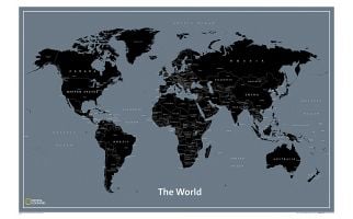 The World for Kids
National Geographic’s The World for Kids wall map is an enticing and engaging world map perfect for classroom, home or library. Recommended by geography educators for ages 7 – 12, this map features an optimized map design for readability and easy, intuitive learning. All 195 independent countries and their official, colorful flags are represented and arranged in alphabetical order for ease-of-use. Expertly researched, The World for Kids map is an essential reference tool for today’s interesting geographical world. All proceeds from the purchase of a National Geographic map help support the Society’s vital exploration, conservation, scientific research, and education programs.
Learn MorePrice from $35.99