National Parks
Find National Parks maps of the US, UK, Canada, and many other countries. These maps highlight magnificent national parks and trails with separate inset maps providing detailed descriptions of relief, landscapes, river systems with updated trail and road information. Rich topographic details and splendid scenery makes these maps a must have while traveling and exploring.
-
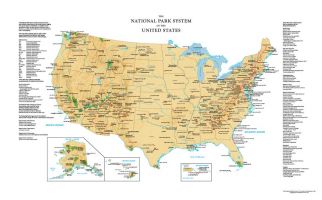 USA National Park Service Wall Map
This map brings you the locations of all the National Parks in the United States. It provides information on all the park sites operated by the National Park System of the US. State borders are demarcated for the easy location of these sites.
This Map of USA features 54 parks all over the country. Projected on a sand-colored base it provides a stunning visual. Attractive and informative, it makes a great map for reference in Tourism centers, NGOs, Schools, and Museums.
Learn MorePrice from $24.99 -
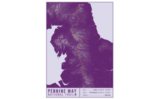 Pennine Way National Trail Map Print
This map print highlights the National Trail route of the Pennine Way, showing the start and finish points on an attractive relief base and created in the official National Trail colours.
Learn MorePrice from $27.99 -
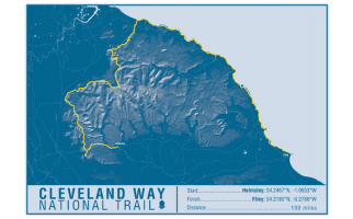 Cleveland Way National Trail Map Print
This map print highlights the National Trail route of the Cleveland Way, showing the start and finish points on an attractive relief base and created in the official National Trail colours.
Learn MorePrice from $27.99 -
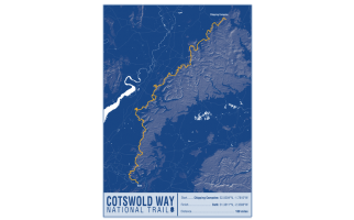 Cotswold Way National Trail Map Print
This map print highlights the National Trail route of the Cotswold Way, showing the start and finish points on an attractive relief base and created in the official National Trail colours.
Learn MorePrice from $27.99 -
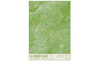 Glyndwr's Way National Trail Map Print
This map print highlights the National Trail route of the Glyndwr's Way, showing the start and finish points on an attractive relief base and created in the official National Trail colours.
Learn MorePrice from $27.99 -
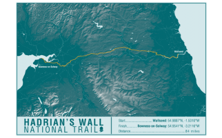 Hadrian's Wall Path National Trail Map Print
This map print highlights the National Trail route of the Hadrian's Wall Path, showing the start and finish points on an attractive relief base and created in the official National Trail colours.
Learn MorePrice from $27.99 -
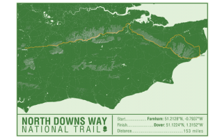 North Downs Way National Trail Map Print
This map print highlights the National Trail route of the North Downs Way, showing the start and finish points on an attractive relief base and created in the official National Trail colours.
Learn MorePrice from $27.99 -
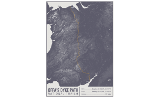 Offa's Dyke Path National Trail Map Print
This map print highlights the National Trail route of the Offa's Dyke Path, showing the start and finish points on an attractive relief base and created in the official National Trail colours.
Learn MorePrice from $27.99 -
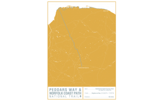 Peddars Way and Norfolk Coast Path National Trail Map Print
This map print highlights the National Trail route of the Peddars Way and Norfolk Coast Path, showing the start and finish points on an attractive relief base and created in the official National Trail colours.
Learn MorePrice from $27.99 -
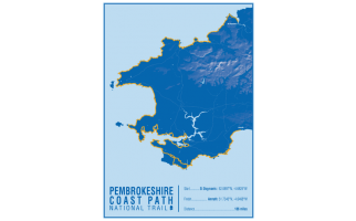 Pembrokeshire Coast Path National Trail Map Print
This map print highlights the National Trail route of the Pembrokeshire Coast Path, showing the start and finish points on an attractive relief base and created in the official National Trail colours.
Learn MorePrice from $27.99 -
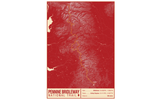 Pennine Bridleway National Trail Map Print
This map print highlights the National Trail route of the Pennine Bridleway, showing the start and finish points on an attractive relief base and created in the official National Trail colours.
Learn MorePrice from $27.99 -
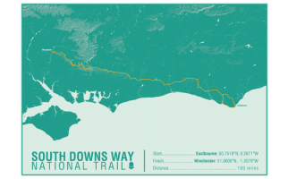 South Downs Way National Trail Map Print
This map print highlights the National Trail route of the South Downs Way, showing the start and finish points on an attractive relief base and created in the official National Trail colours.
Learn MorePrice from $27.99