Top World Maps
Find every bestselling world map from eminent map publishers in one place! Ranging from legacy maps, Pacific centered maps, to the graphic world map, this collection has it all. These maps are a great source for both geographic and political information. Available in various styles like antique, classic, and contemporary they are perfect for home, business, and educational references.
-
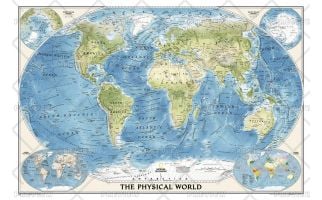 World Physical Map
National Geographic's World Physical - Ocean Floor map highlights the Earth's land and undersea forms with exquisite hand-painted relief. Drawn in the Winkel Tripel projection to minimize distortion of the landforms. Two corner inset maps show the Earth's crust and world climatic zones.
Learn MorePrice from $37.99 -
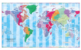 Time Zone Wall Map of the World
Colourful yet informative map. Combined with a detailed political map of the world, contrasting colours are used to accurately depict the different time zones, both on land and in the oceans.
Learn MorePrice from $34.99 -
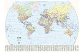 World Wall Map - English and French
This world wall map has been designed with all text in both French and English, making this an ideal product in Canada for schools, businesses and public areas.
This political map, with a useful place name index, is ideal for classrooms and other public areas.
Learn MorePrice from $34.99 -
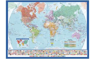 World Wall Map with Flags - English and French
This world map has been designed with all text in both French and English, making this an ideal product in Canada for schools, businesses and public areas.
This political map, with all the worlds flags, is ideal for classrooms and other public areas.
Learn MorePrice from $36.99 -
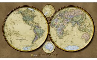 World Hemispheres
During the 1930's and 1940's, several National Geographic world maps were designed using a projection that separated the eastern and western hemispheres. We have brought back this classic view of the world with updated, modern cartography and an elegant earth-tone color palette. This new, yet fashionably retro, world map is the World Hemispheres.
Learn MorePrice from $39.99 -
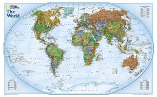 World Explorer
The colorful World Explorer map is designed using the Winkel Tripel projection, which reduces the distortion of land masses near the poles. Inset charts list largest cities by population and the largest countries by land mass and population.
Learn MorePrice from $31.99 -
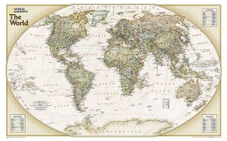 World Explorer Executive
One of our most popular and accurate world maps is now available in our rich, antique-inspired Executive style. Contains up-to-date place names.
Learn More
The World Explorer Executive uses the Winkel-Tripel Map Projection, which strikes the best balance of accuracy, aesthetics, and proportion, eliminating the issue found in many other maps where Greenland appears larger than South America.
Includes accurate political boundaries and place names, time zone chart, latitude and longitude grids, and three inset tables with the world's largest countries by size and population, and the population of the world's largest urban areas.Price from $34.99 -
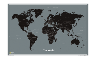 World Modern
National Geographic’s World Modern wall map features clearly labeled countries, major cities and oceans for easy reference combined with a clean, contemporary design and color palette. This unique map is a convenient standard poster size (24” x 36”), perfect for home or office. All proceeds from the purchase of a National Geographic map help support the Society’s vital exploration, conservation, scientific research, and education programs.
Learn MorePrice from $34.99